

TUESDAY, AUGUST 31, 2021
Thanks to a new online course from Clemson University, contractors can now enroll in a five-module course for certifications in applied drone technology.
The five-module course reportedly teaches the fundamentals of commercial drone operations and software applications. Key learning objectives include:
Offered through self-paced and instructor-led options, the course uses a combination of flight simulation programs to teach flight skills and ContextCapture, a SfM software, to create 3D models and maps. The self-paced course is reported to take 10 weeks and includes a collection of videos, voiceover powerpoints and written e-material, while the instructor-led course is led by Joe Burgett, an associate professor from Clemson’s Nieri Family Department of Construction Science and Management, and can be completed in an accelerated five weeks.
|
|
| Elmekkaoui abdelghani, CC-BY-SA-4.0, via Wikimedia Commons |
|
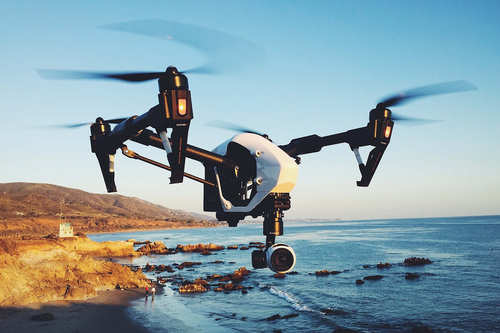
Thanks to a new online course from Clemson University, contractors can now enroll in a five-module course for certifications in applied drone technology. |
At Clemson, Burgett teaches both undergraduate- and graduate-level courses on drone application in the built environment. By trade, he is a general contractor and has worked exclusively with the South Carolina Department of Transportation. Throughout his career, Burgett has published multiple peer-reviewed articles on UAS technology, including titles such as “Accuracy of Drone Image Based Volumetric Surveys,” “Evaluating the Use of Unmanned Aerial Systems (UAS) to Perform Low-Slope Roof Inspections” and “SCiDUC: Solution to Address Common Challenges of State Agency Drone Deployment.”
In 2018, Burgett was named Clemson’s Master Teacher.
The five-module course is broken down as follows:
(Note: the FAA exam fee is not included with the course.)
For enrollment fee information, click here. Contractors looking to participate in the online course—provided through Clemson’s “Canvas” online learning management system—will need a smart device and a PC computer. The university recommends a MS Windows 8.1 or better, Intel/AMD CPU 1.0GHz, any Nvidia, AMD or Intel GPU compatible with OpenGL 3.2, 16Gb RAM, and 100Gb - SATA Drive.


Drones in Universities
Researchers from the University of Newcastle School of Engineering reported in March that they’d begun developing a new drone technology to help predict what areas and specific pipes are at risk of water loss through corrosion.


While the risk of degradation is traditionally dependent on an underground water supply network’s age and the amount of moisture in the ground surrounding the infrastructure, more recently, sensor devices have been deployed at specific sites to measure water flow to indicate leaks or breaks.
The technique utilizes a Light Detection and Ranging sensor, commonly referred to as LiDAR, which is a remote sensing method that uses a pulsed laser to measure ranges and variable distances to the Earth. From the differences collected in laser return times and wavelengths, the data can then be used to make digital 3D-representations of the landscape and indicate the amount of water in the ground.


The LiDAR drone technology research headed by University of Newcastle investigates soil moisture and corrosion and is part of a larger innovative smart water management project coordinated by NSW Smart Sensing Network (NSSN) and is led by Sydney Water.
Tagged categories: Colleges and Universities; Digital tools; drone; Drones; Education; Online tools; Program/Project Management; Technology; Tools & Equipment

